Antarctica2.jpg
From Spacefaring
No higher resolution available.
Antarctica2.jpg (700 × 567 pixels, file size: 76 KB, MIME type: image/jpeg)

|
This map has been uploaded by Electionworld from en.wikipedia.org to enable the |
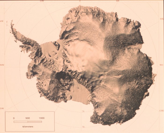
Shaded relief map of Antarctica developed from RADARSAT Synthetic Aperture Radar data. RADARSAT is a Canadian satellite.
Source: U.S. National Oceanic & Atmospheric Administration
This image is in the public domain because it contains materials that originally came from the U.S. National Oceanic and Atmospheric Administration, taken or made as part of an employee's official duties.
|
File history
Click on a date/time to view the file as it appeared at that time.
| Date/Time | Thumbnail | Dimensions | User | Comment | |
|---|---|---|---|---|---|
| current | 23:22, 1 December 2006 | | 700 × 567 (76 KB) | wikimediacommons>Electionworld | {{ew|en|Andre Engels}} Shaded relief map of Antarctica developed from RADARSAT Synthetic Aperture Radar data. RADARSAT is a Canadian satellite. Source: U.S. National Oceanic & Atmospheric Administration {{PD-USGov-NOAA}} [http://www.photolib.noaa.gov/c |
File usage
There are no pages that use this file.