Kontur tanah di gunung bromo.jpg
From Spacefaring

Size of this preview: 400 × 600 pixels. Other resolutions: 160 × 240 pixels | 320 × 480 pixels | 512 × 768 pixels | 682 × 1,024 pixels | 1,365 × 2,048 pixels | 4,000 × 6,000 pixels.
Original file (4,000 × 6,000 pixels, file size: 7.89 MB, MIME type: image/jpeg)
Summary
| Description |
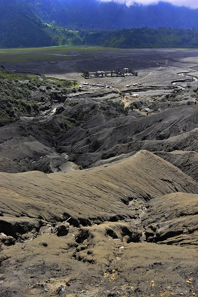
Bahasa Indonesia: gunung bromo yang terletak di kawasan Taman Nasional Bromo Tengger Semeru ini menyajikan kontur tanah pada lerengan yang cukup unik. aktivitas gunung merapi aktif yang cukup intens dalam mengeluarkan material gunung Merapi seperti pasir pada saat letusan, mengakibatkan daerah sekitar kawah akan menerima timbunan pasir yang cukup tebal. saat curah hujan tinggi, material pasir yang menimbun lereng-lereng gunung bromo ini akan terukir dengan sendirinya oleh aliran air hujan dari bibir kawah dan membentuk kontur yang sangat menarik dan surreal. area yang berada di empat kabupaten sekaligus, yakni kabupaten malang, kabupaten pasuruan, kabupaten lumajang dan kabupaten probolinggo ini telah menyedot jutaan pengunjung tiap tahunnya |
| Date | |
| Source | Own work |
| Author | Chafidwahyu |
| Camera location | | View this and other nearby images on: OpenStreetMap |
|---|
Licensing
I, the copyright holder of this work, hereby publish it under the following licence:
This file is licensed under the Creative Commons Attribution-Share Alike 4.0 International licence.
- You are free:
- to share – to copy, distribute and transmit the work
- to remix – to adapt the work
- Under the following conditions:
- attribution – You must give appropriate credit, provide a link to the licence, and indicate if changes were made. You may do so in any reasonable manner, but not in any way that suggests the licensor endorses you or your use.
- share alike – If you remix, transform, or build upon the material, you must distribute your contributions under the same or compatible licence as the original.
This image was uploaded as part of Wiki Loves Earth 2020.
|
 |
File history
Click on a date/time to view the file as it appeared at that time.
| Date/Time | Thumbnail | Dimensions | User | Comment | |
|---|---|---|---|---|---|
| current | 08:05, 27 May 2020 | | 4,000 × 6,000 (7.89 MB) | wikimediacommons>Chafidwahyu | Uploaded own work with UploadWizard |
File usage
There are no pages that use this file.