Mountain rescue hut, Legsteinalm.jpg
From Spacefaring
Original file (2,860 × 1,988 pixels, file size: 5.44 MB, MIME type: image/jpeg)
This file is from Wikimedia Commons and may be used by other projects. The description on its file description page there is shown below.
Summary
| DescriptionMountain rescue hut, Legsteinalm.jpg |
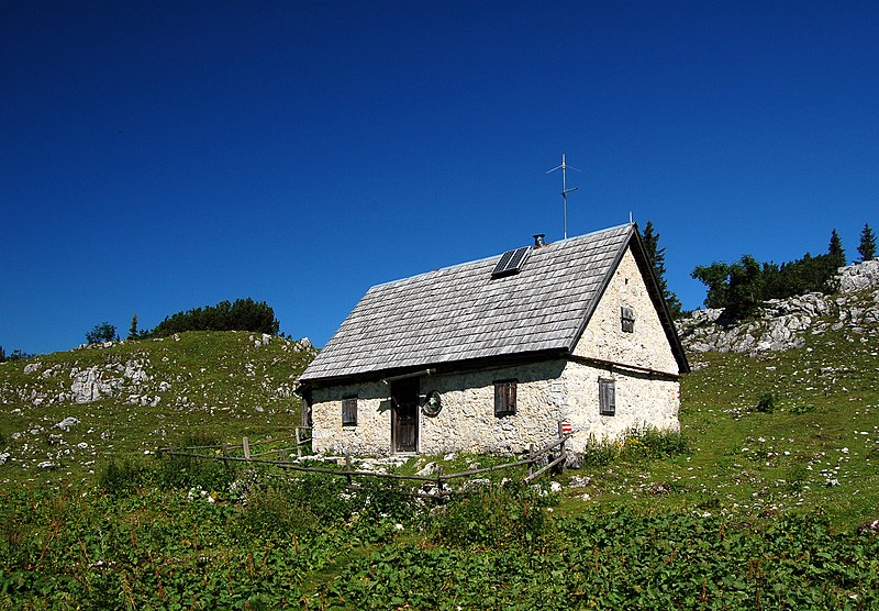
English: Hut of the Austrian Mountain Rescue organization (ÖBRD), section Lunz am See, in the Dürrenstein area, Legsteinalm (~1440m) following the track to the Dürrenstein summit, Lower Austria.
Deutsch: Bergrettungsdiensthütte der Ortsstelle Lunz am See des ÖBRD auf der Legsteinalm (rund 1440) am Weg zum Dürrenstein-Gipfel. Niederösterreich. |
| Date | |
| Source | Own work |
| Author | Herzi Pinki |
| Camera location | 47° 48′ 05.82″ N, 15° 02′ 31.1″ E | View this and other nearby images on: OpenStreetMap |
|---|
Licensing
- You are free:
- to share – to copy, distribute and transmit the work
- to remix – to adapt the work
- Under the following conditions:
- attribution – You must give appropriate credit, provide a link to the licence, and indicate if changes were made. You may do so in any reasonable manner, but not in any way that suggests the licensor endorses you or your use.
- share alike – If you remix, transform, or build upon the material, you must distribute your contributions under the same or compatible licence as the original.
| Permission is granted to copy, distribute and/or modify this document under the terms of the GNU Free Documentation Licence, Version 1.2 or any later version published by the Free Software Foundation; with no Invariant Sections, no Front-Cover Texts, and no Back-Cover Texts. A copy of the licence is included in the section entitled GNU Free Documentation Licence.http://www.gnu.org/copyleft/fdl.htmlGFDLGNU Free Documentation Licensetruetrue |
This image has been assessed using the Quality image guidelines and is considered a Quality image.
العربية ∙ جازايرية ∙ беларуская ∙ беларуская (тарашкевіца) ∙ български ∙ বাংলা ∙ català ∙ čeština ∙ Cymraeg ∙ Deutsch ∙ Schweizer Hochdeutsch ∙ Zazaki ∙ Ελληνικά ∙ English ∙ Esperanto ∙ español ∙ eesti ∙ euskara ∙ فارسی ∙ suomi ∙ français ∙ galego ∙ עברית ∙ हिन्दी ∙ hrvatski ∙ magyar ∙ հայերեն ∙ Bahasa Indonesia ∙ italiano ∙ 日本語 ∙ Jawa ∙ ქართული ∙ Qaraqalpaqsha ∙ 한국어 ∙ kurdî ∙ кыргызча ∙ Latina ∙ Lëtzebuergesch ∙ lietuvių ∙ македонски ∙ മലയാളം ∙ मराठी ∙ Bahasa Melayu ∙ Nederlands ∙ Norfuk / Pitkern ∙ polski ∙ português ∙ português do Brasil ∙ rumantsch ∙ română ∙ русский ∙ sicilianu ∙ slovenčina ∙ slovenščina ∙ shqip ∙ српски / srpski ∙ svenska ∙ தமிழ் ∙ తెలుగు ∙ ไทย ∙ Tagalog ∙ toki pona ∙ Türkçe ∙ українська ∙ oʻzbekcha / ўзбекча ∙ vèneto ∙ Tiếng Việt ∙ 中文 ∙ 中文(简体) ∙ 中文(繁體) ∙ +/− |
Captions
21 July 2010
47°48'5.825"N, 15°2'31.096"E
0.003125 second
22 millimetre
image/jpeg
File history
Click on a date/time to view the file as it appeared at that time.
| Date/Time | Thumbnail | Dimensions | User | Comment | |
|---|---|---|---|---|---|
| current | 11:08, 27 January 2013 | 2,860 × 1,988 (5.44 MB) | wikimediacommons>Slick-o-bot | Bot: convert to a non-interlaced jpeg (see bug #17645) |
File usage
There are no pages that use this file.
Metadata
This file contains additional information, probably added from the digital camera or scanner used to create or digitise it.
If the file has been modified from its original state, some details may not fully reflect the modified file.
| Camera manufacturer | NIKON CORPORATION |
|---|---|
| Camera model | NIKON D50 |
| Exposure time | 1/320 sec (0.003125) |
| F Number | f/9 |
| Date and time of data generation | 10:25, 21 July 2010 |
| Lens focal length | 22 mm |
| Latitude | 47° 48′ 7.61″ N |
| Longitude | 15° 2′ 31.32″ E |
| Altitude | 1,457.264 metres above sea level |
| Image title | Bergrettungsdiensthütte der Ortsstelle Lunz am See auf der Legsteinalm am Dürrenstein, NÖ |
| Short title | Bergrettungsdiensthütte |
| City shown | Steinbach |
| Orientation | Normal |
| Horizontal resolution | 300 dpi |
| Vertical resolution | 300 dpi |
| Software used | PictureProject 1.7 W |
| File change date and time | 01:16, 24 July 2010 |
| Y and C positioning | Centred |
| Exposure Program | Normal program |
| Exif version | 2.21 |
| Date and time of digitising | 10:25, 21 July 2010 |
| Meaning of each component |
|
| APEX exposure bias | −1 |
| Maximum land aperture | 3.7 APEX (f/3.61) |
| Metering mode | Pattern |
| Light source | Unknown |
| Flash | Flash did not fire |
| DateTime subseconds | 60 |
| DateTimeOriginal subseconds | 60 |
| DateTimeDigitised subseconds | 60 |
| Supported Flashpix version | 1 |
| Colour space | sRGB |
| Sensing method | One-chip colour area sensor |
| File source | Digital still camera |
| Scene type | A directly photographed image |
| Custom image processing | Normal process |
| Exposure mode | Auto exposure |
| White balance | Auto white balance |
| Digital zoom ratio | 1 |
| Focal length in 35 mm film | 33 mm |
| Scene capture type | Standard |
| Scene control | None |
| Contrast | Normal |
| Saturation | Normal |
| Sharpness | Normal |
| Subject distance range | Unknown |
| GPS time (atomic clock) | 08:12 |
| Geodetic survey data used | WGS-84 |
| GPS date | 21 July 2010 |
| GPS tag version | 2.2.0.0 |
| IIM version | 2 |
| Province or state shown | Niederösterreich |
| Country shown | Österreich |
| Keywords |
|