PAGEOS
From Spacefaring
Q2043671
PAGEOS was a balloon satellite which was launched by NASA in June 1966. It was the first satellite specifically launched for use in geodetic surveying, or measuring the shape of the earth, by serving as a reflective and photographic tracking target. At the time, it improved on terrestrial triangulations of the globe by about an order of magnitude. The satellite, which carried no instrumentation, broke up between 1975 and 1976. One of the largest fragments of the satellite finally deorbited in 2016.
1966
Wikimedia, Wikidata
National Aeronautics and Space Administration,
NASA, satellite, Dong Fang Hong 2, Ekran, 1966, passive satellite, 1960s,
-
Location: KML, Cluster Map, Maps,
1966-06-24T00:00:00Z
1966-06-24T00:00:00Z
1966 PAGEOS
1966-06-24T00:00:00Z
1966-06-24T00:00:00Z
rocket launch
{"selectable":false,"showCurrentTime":false,"width":"100%","zoomMin":100000000000}
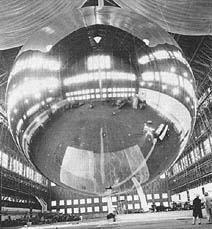 PAGEOS 1
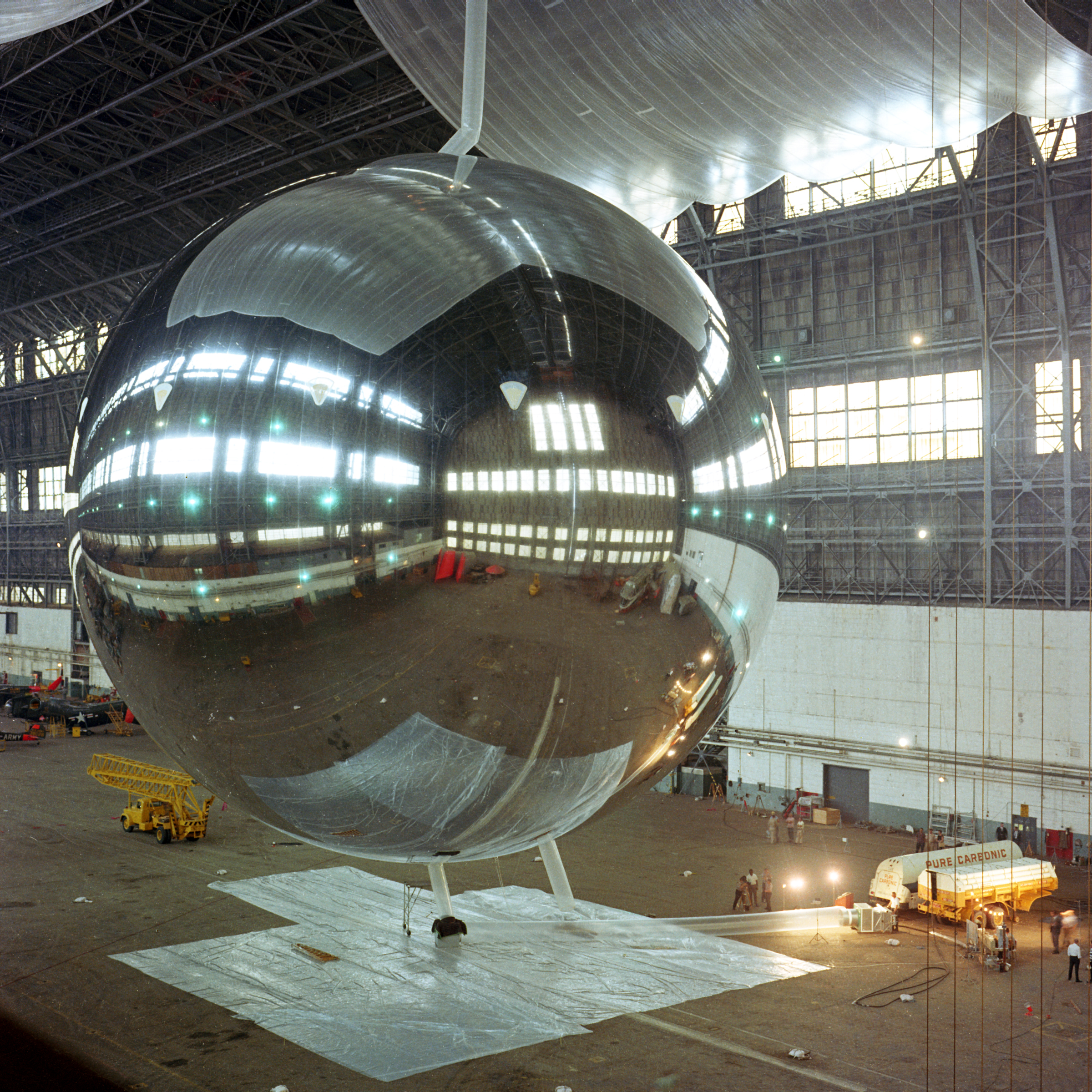 PAGEOS Satellite - GPN-2000-001896
 1966-056 (Thor SLV-2A Agena D)
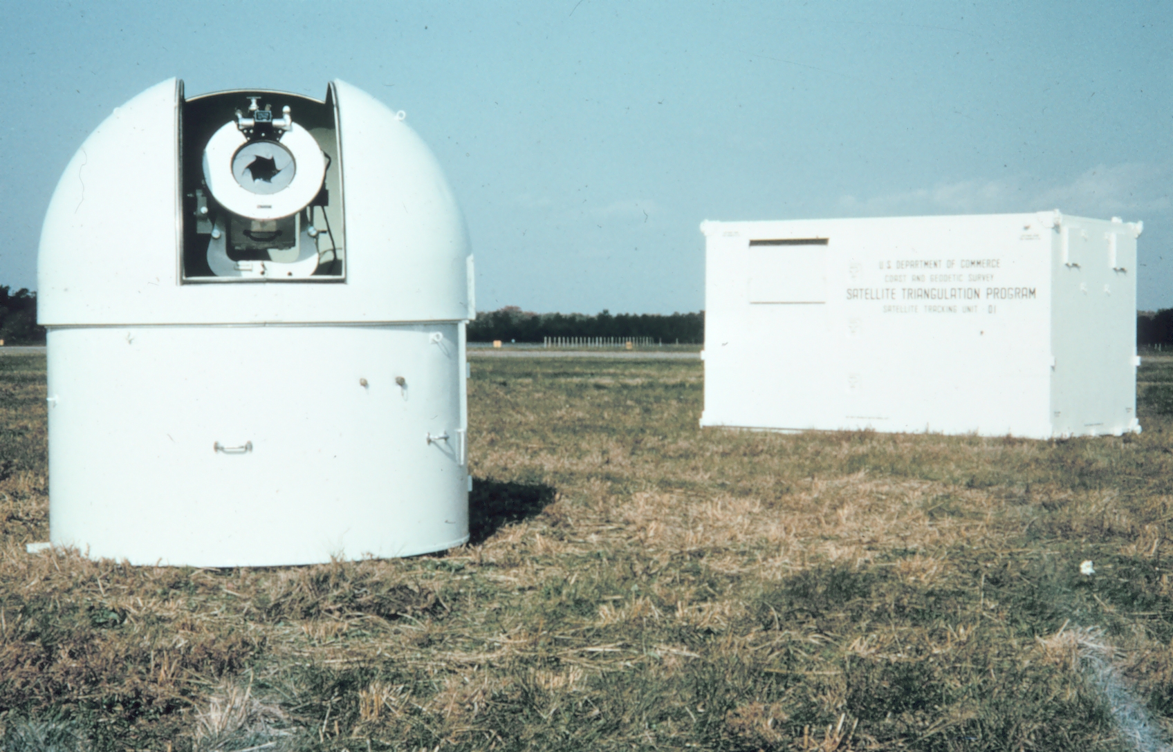 A BC4 (Ballistic Camera-4) camera, inside its observing dome, with instrumentation shelter in background.
| Type | Subtype | Date | Description | Notes | Source |
|---|---|---|---|---|---|
| commons | image | PAGEOS 1 | Commons | ||
| commons | image | PAGEOS Satellite - GPN-2000-001896 | Commons | ||
| commons | image | 1966-056 (Thor SLV-2A Agena D) | Commons | ||
| commons | image | A BC4 (Ballistic Camera-4) camera, inside its observing dome, with instrumentation shelter in background. | Commons | ||
.jpg)