NOAA-6
From Spacefaring
Q28401183
NOAA-6, known as NOAA-A before launch, was an American operational weather satellite for use in the National Operational Environmental Satellite System (NOESS) and for the support of the Global Atmospheric Research Program (GARP) during 1978–1984. The satellite design provided an economical and stable Sun-synchronous platform for advanced operational instruments to measure the atmosphere of Earth, its surface and cloud cover, and the near-space environment.
1979
Wikimedia, Wikidata
NOAA-A
RCA Corporation, National Oceanic and Atmospheric Administration, United States,
United States, Dong Fang Hong 2, Ekran, TIROS-N, weather satellite, 1979, 1970s,
-
Location: KML, Cluster Map, Maps,
1979-06-27T00:00:00Z
1979-06-27T00:00:00Z
1979 NOAA-6
1987-03-31T00:00:00Z
1987-03-31T00:00:00Z
service retirement
1979-06-27T00:00:00Z
1979-06-27T00:00:00Z
rocket launch
{"selectable":false,"showCurrentTime":false,"width":"100%","zoomMin":100000000000}
 Scientist Frank Porto at the tape drives of the then new National EnvironmentalSatellite Service (NESS) mass data storage system, the SDC TBMII.
 Scientist Frank Porto at the tape drives of the then new National EnvironmentalSatellite Service (NESS) mass data storage system, the SDC TBMII.
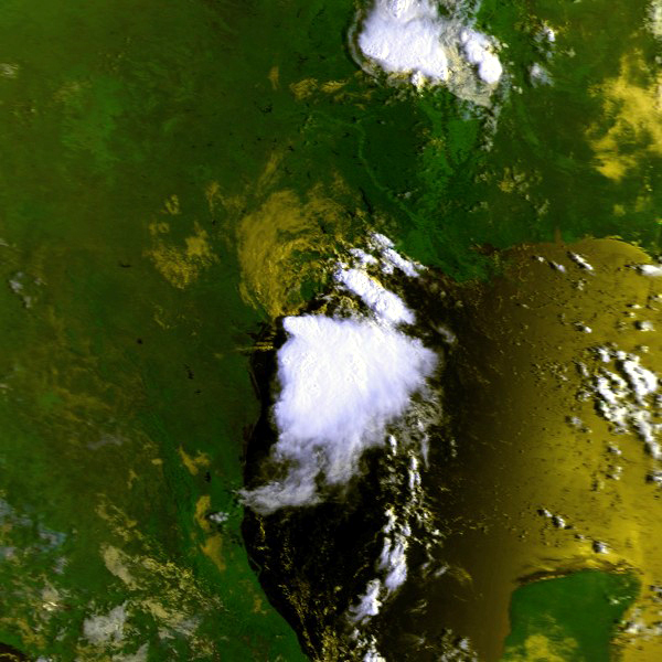 Elena 01 sep 1979 1404Z N6
 Hyacinthe 25 jan 1980 0326Z N6
 Western United States, 1 hour, 36 minutes after Mount St Helens eruption, May 18, 1980 (GLACIERS 7188)
 Western United States, 6 hours, 36 minutes after Mount St Helens eruption, May 18, 1980 (GLACIERS 7192)
 Western United States, 2 hours, 6 minutes after Mount St Helens eruption, May 18, 1980 (GLACIERS 7190)
 Western United States, 3 hours, 36 minutes after Mount St Helens eruption, May 18, 1980 (GLACIERS 7193)
 Western United States, 5 hours, 36 minutes after Mount St Helens eruption, May 18, 1980 (GLACIERS 7187)
 Ash cloud, with Seattle, Tacoma, and Yakima, and Portland Oregon, and Mount St Helens marked for reference, May 18,1980 (GLACIERS 7182)
_mass_data_storage_system,_the_SDC_TBMII_This_systemwas_used_to_archive_all_of_the_TIROS-N_and_NOAA-6_digital_data_on_s_(2268-218).jpg)
_mass_data_storage_system,_the_SDC_TBMII_This_systemwas_used_to_archive_all_of_the_TIROS-N_and_NOAA-6_digital_data_on_s_(2268-219).jpg)
.jpg)
.jpg)
.jpg)
.jpg)
.jpg)
.jpg)