Improved TIROS Operational System
From Spacefaring
Q97655631
model of American meteorological satellite
Wikimedia, Wikidata
ITOS
United States,
United States, Dong Fang Hong 2, Ekran, weather satellite,
-
Location: KML, Cluster Map, Maps,
 Graphic of overall ITOS system.
 Prelaunch ITOS Spac0076-repair
 Graphic of ITOS system data flow.
 ITOS meteorological satellite
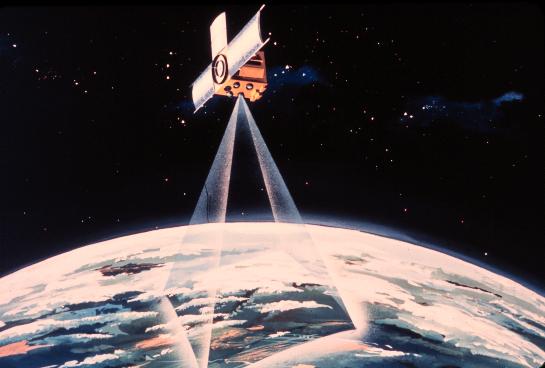 Graphic of ITOS Spac0077
 Graphic of ITOS Spac0077-repair
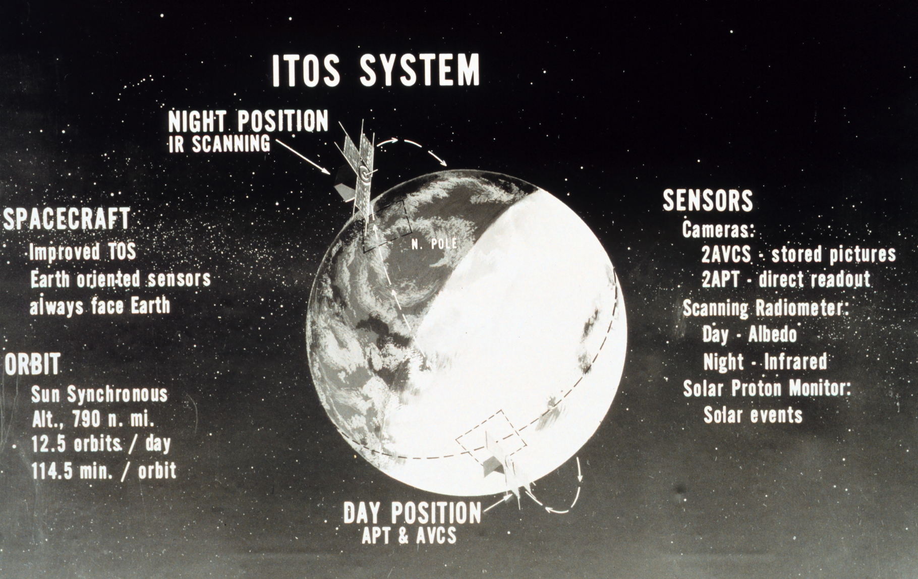
 Graphic of Improved TIROS Operational System (ITOS) satellite.satellite series orbital parameters and sensors.
 Graphic of Improved TIROS Operational System (ITOS) satellite system data flow.
 Graphic of TIROS M, also known as ITOS-1.
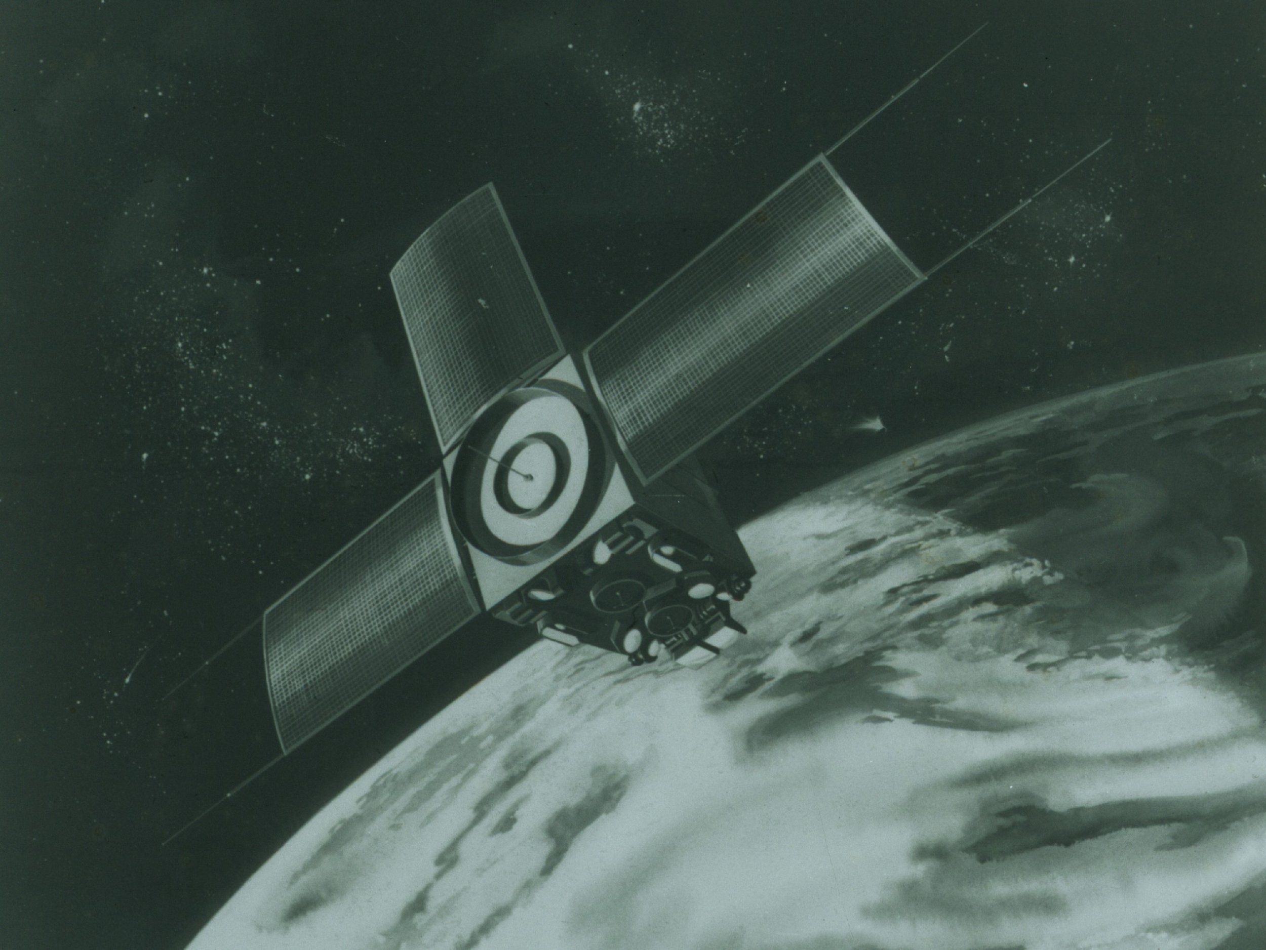 ITOS meteorological satellite
| Type | Subtype | Date | Description | Notes | Source |
|---|---|---|---|---|---|
| commons | image | Graphic of overall ITOS system. | Commons | ||
| commons | image | Prelaunch ITOS Spac0076-repair | Commons | ||
| commons | image | Graphic of ITOS system data flow. | Commons | ||
| commons | image | ITOS meteorological satellite | Commons | ||
| commons | image | Graphic of ITOS Spac0077 | Commons | ||
| commons | image | Graphic of ITOS Spac0077-repair | Commons | ||
| commons | image | Graphic of Improved TIROS Operational System (ITOS) satellite.satellite series orbital parameters and sensors. | Commons | ||
| commons | image | Graphic of Improved TIROS Operational System (ITOS) satellite system data flow. | Commons | ||
| commons | image | Graphic of TIROS M, also known as ITOS-1. | Commons | ||
| commons | image | ITOS meteorological satellite | Commons | ||
.jpg)
.jpg)
.jpg)
_satellite_satellite_series_orbital_parameters_and_sensors_(2297-12).jpg)
_satellite_system_data_flow_(2297-13).jpg)
.jpg)
.jpg)