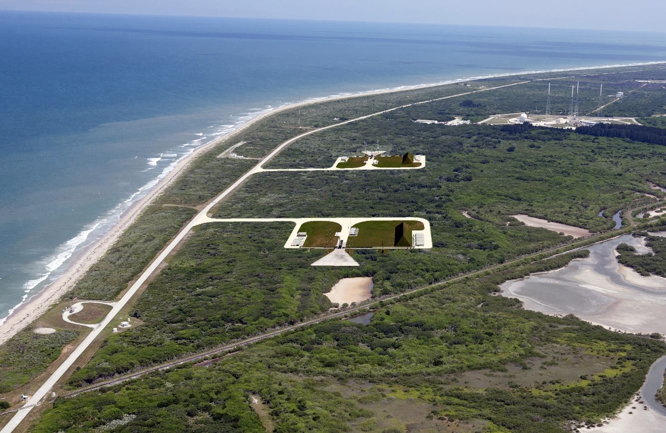
Kennedy Space Center Launch Complex 48
From Spacefaring
Q81280973
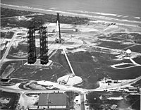
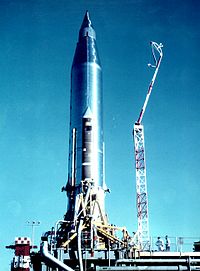
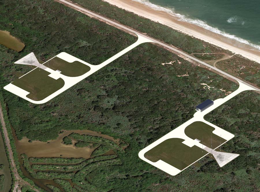
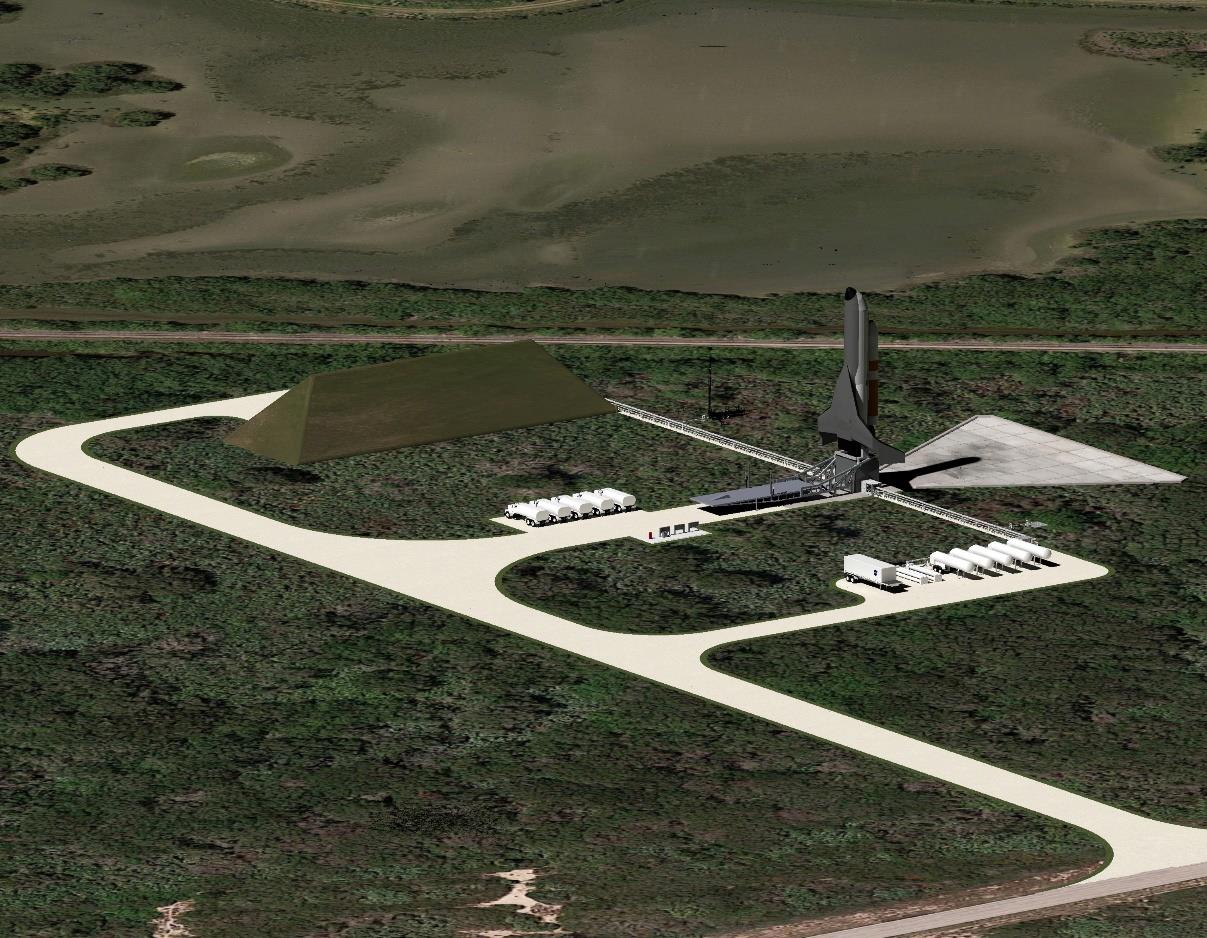
Launch Complex 48 (LC-48) is a multi-user launch site for small launchers and spacecraft. It is located south of Launch Complex 39A and north of Space Launch Complex 41.
2020
Wikimedia, Wikidata
LC-48; Launch Complex 48
National Aeronautics and Space Administration, United States, 
-
Location: 28.5988, -80.5891, KML, Cluster Map, Maps,
49 places
-

Kennedy Space Center Launch Complex 39A ⓘ
launch pad at Kennedy Space Center Launch Complex 39 -

Kennedy Space Center Launch Complex 39B ⓘ
launch pad at Kennedy Space Center Launch Complex 39 -

Launch Complex 1 ⓘ
deactivated US Air Force launch site -

Kennedy Space Center Launch Complex 39C ⓘ
launch pad at Kennedy Space Center Launch Complex 39 -

Kennedy Space Center Launch Complex 48 ⓘ
rocket launch site at Kennedy Space Center, Florida, USA -

Kennedy Space Center Launch Complex 49 ⓘ
proposed rocket launch site at Kennedy Space Center in Florida, USA -

Spaceport Florida Launch Complex 36 ⓘ
rocket launch site in Brevard County, Florida -

Kennedy Space Center ⓘ
United States space launch site in Florida -

Kennedy Space Center Launch Complex 39 ⓘ
rocket launch site at Kennedy Space Center in Florida, USA
2020-12-01T00:00:00Z
2020-12-01T00:00:00Z
2020 Kennedy Space Center Launch Complex 48
2018-01-01T00:00:00Z
2018-01-01T00:00:00Z
design
2020-12-01T00:00:00Z
2020-12-01T00:00:00Z
opening
2019-11-01T00:00:00Z
2019-11-01T00:00:00Z
construction
2016-01-01T00:00:00Z
2016-01-01T00:00:00Z
planning
1953-01-01T00:00:00Z
1953-01-01T00:00:00Z
1953-01-01T00:00:00Z
1953-01-01T00:00:00Z
1953-01-01T00:00:00Z
2001-01-01T00:00:00Z
1955-01-01T00:00:00Z
1955-01-01T00:00:00Z
1955-01-01T00:00:00Z
1959-01-01T00:00:00Z
1955-01-01T00:00:00Z
1967-02-01T00:00:00Z
1955-01-01T00:00:00Z
1955-01-01T00:00:00Z
1956-01-01T00:00:00Z
2013-01-01T00:00:00Z
1956-01-01T00:00:00Z
2009-09-01T00:00:00Z
1956-01-01T00:00:00Z
1956-01-01T00:00:00Z
1956-01-01T00:00:00Z
1956-01-01T00:00:00Z
1956-01-01T00:00:00Z
2018-01-01T00:00:00Z
1956-01-01T00:00:00Z
2018-01-01T00:00:00Z
1957-01-01T00:00:00Z
1957-01-01T00:00:00Z
1957-01-01T00:00:00Z
1957-01-01T00:00:00Z
1957-03-01T00:00:00Z
1969-09-01T00:00:00Z
1957-07-01T00:00:00Z
1961-10-01T00:00:00Z
1958-01-01T00:00:00Z
1958-01-01T00:00:00Z
1958-06-04T00:00:00Z
1967-02-01T00:00:00Z
1959-01-01T00:00:00Z
1959-01-01T00:00:00Z
1965-06-18T00:00:00Z
1965-06-18T00:00:00Z
1965-12-21T00:00:00Z
1965-12-21T00:00:00Z
1967-01-01T00:00:00Z
1979-01-01T00:00:00Z
1967-01-01T00:00:00Z
1979-01-01T00:00:00Z
1949-01-01T00:00:00Z
1949-01-01T00:00:00Z
1952-01-01T00:00:00Z
1952-01-01T00:00:00Z
1955-01-01T00:00:00Z
1955-01-01T00:00:00Z
1956-01-01T00:00:00Z
1956-01-01T00:00:00Z
1957-03-01T00:00:00Z
1979-01-01T00:00:00Z
1958-08-01T00:00:00Z
1980-01-01T00:00:00Z
1960-01-01T00:00:00Z
1960-01-01T00:00:00Z
{"selectable":false,"showCurrentTime":false,"width":"100%","zoomMin":100000000000}
| Type | Subtype | Date | Description | Notes | Source |
|---|---|---|---|---|---|
| class | rocket | 1985 | Space Shuttle Atlantis | Space Shuttle orbiter, exhibit | Wikidata |
| class | rocket | 1992 | Inspiration | mockup, Space Shuttle orbiter, exhibit | Wikidata |
| organisation | organisation | Sidus Space | business company | Wikidata | |
| organisation | organisation | 2016 | Vaya Space | launch service provider | Wikidata |
| site | launch pad | Cape Canaveral Launch Complex 26 | launch pad | Wikidata | |
| site | launch pad | Cape Canaveral Launch Complex 31 | launch pad | Wikidata | |
| site | launch pad | Cape Canaveral Launch Complex 34 | launch pad | Wikidata | |
| site | launch pad | Cape Canaveral Launch Complex 37A | launch pad | Wikidata | |
| site | launch pad | Cape Canaveral Space Launch Complex 37B | launch pad | Wikidata | |
| site | launch pad | Cape Canaveral Space Launch Complex 46 | launch pad | Wikidata | |
| site | launch pad | Kennedy Space Center Launch Complex 39A | launch pad | Wikidata | |
| site | launch pad | Kennedy Space Center Launch Complex 39B | launch pad | Wikidata | |
| site | launch pad | 1953 | Cape Canaveral Launch Complex 2 | launch pad, military installation | Wikidata |
| site | launch pad | 1953 | Cape Canaveral Launch Complex 3 | launch pad, military installation | Wikidata |
| site | launch pad | 1953 | Cape Canaveral Launch Complex 9 | launch pad, military installation | Wikidata |
| site | launch pad | 1953 | Launch Complex 1 | launch pad, military installation | Wikidata |
| site | launch pad | 1955 | Cape Canaveral Air Force Station Launch Complex 5 | launch pad, military installation | Wikidata |
| site | launch pad | 1955 | Cape Canaveral Launch Complex 10 | military installation, launch pad | Wikidata |
| site | launch pad | 1955 | Cape Canaveral Launch Complex 18A | launch pad, former entity | Wikidata |
| site | launch pad | 1955 | Cape Canaveral Launch Complex 6 | launch pad, military installation | Wikidata |
| site | launch pad | 1956 | Cape Canaveral Launch Complex 11 | launch pad, military installation | Wikidata |
| site | launch pad | 1956 | Cape Canaveral Launch Complex 12 | launch pad, military installation | Wikidata |
| site | launch pad | 1956 | Cape Canaveral Space Launch Complex 13 | launch pad, military installation, replaced entity | Wikidata |
| site | launch pad | 1956 | Cape Canaveral Space Launch Complex 14 | launch pad, military installation | Wikidata |
| site | launch pad | 1956 | Cape Canaveral Space Launch Complex 17A | launch pad, former entity | Wikidata |
| site | launch pad | 1956 | Cape Canaveral Space Launch Complex 17B | launch pad, former entity | Wikidata |
| site | launch pad | 1957 | Cape Canaveral Launch Complex 16 | launch pad | Wikidata |
| site | launch pad | 1957 | Cape Canaveral Space Launch Complex 15 | launch pad, military installation | Wikidata |
| site | launch pad | 1957 | Cape Canaveral Launch Pad LC-25A | launch pad | Wikidata |
| site | launch pad | 1957 | Cape Canaveral Launch Pad LC-25B | launch pad | Wikidata |
| site | launch pad | 1958 | Cape Canaveral Launch Complex 19 | launch pad, former entity | Wikidata |
| site | launch pad | 1958 | Cape Canaveral Launch Complex 18B | launch pad, former entity | Wikidata |
| site | launch pad | 1959 | Cape Canaveral Space Launch Complex 20 | launch pad | Wikidata |
| site | launch pad | 1965 | Cape Canaveral Air Force Station Space Launch Complex 40 | launch pad | Wikidata |
| site | launch pad | 1965 | Cape Canaveral Space Launch Complex 41 | launch pad | Wikidata |
| site | launch pad | 1967 | Cape Canaveral Launch Pad LC-25C | launch pad | Wikidata |
| site | launch pad | 1967 | Cape Canaveral Launch Pad LC-25D | launch pad | Wikidata |
| site | launch pad | 2015 | Kennedy Space Center Launch Complex 39C | launch pad | Wikidata |
| site | launch pad | 2020 | Kennedy Space Center Launch Complex 48 | launch pad | Wikidata |
| site | rocket launch site | Cape Canaveral Air Force Station Launch Complex 30 | Cape Canaveral Space Force Station, launch site | Wikidata | |
| site | rocket launch site | Cape Canaveral Air Force Station Launch Complex 32 | launch site | Wikidata | |
| site | rocket launch site | Cape Canaveral Space Launch Complex 37 | launch site | Wikidata | |
| site | rocket launch site | Kennedy Space Center Launch Complex 49 | launch site, proposed entity | Wikidata | |
| site | rocket launch site | Spaceport Florida Launch Complex 36 | launch site | Wikidata | |
| site | rocket launch site | 1949 | Cape Canaveral Air Force Station | spaceport, air base | Wikidata |
| site | rocket launch site | 1952 | Cape Canaveral Launch Complex 4 | military installation, launch site | Wikidata |
| site | rocket launch site | 1955 | Cape Canaveral Launch Complex 18 | launch site, former entity | Wikidata |
| site | rocket launch site | 1956 | Cape Canaveral Space Launch Complex 17 | launch site, former entity | Wikidata |
| site | rocket launch site | 1957 | Cape Canaveral Launch Complex 25 | launch site | Wikidata |
| site | rocket launch site | 1958 | Cape Canaveral Launch Complex 29 | launch site | Wikidata |
| site | rocket launch site | 1959 | Kennedy Space Center | spaceport, research institute, NASA facility | Wikidata |
| site | rocket launch site | 1960 | Integrate-Transfer-Launch Complex | launch site | Wikidata |
| site | rocket launch site | 1963 | Kennedy Space Center Launch Complex 39 | launch site | Wikidata |
| commons | image | LC 48 Site Development (KSC-20210601-PH-JBS01 0009) | Commons | ||
| commons | image | LC 48 Site Development (KSC-20210601-PH-JBS01 0008) | Commons | ||
| commons | image | LC-48 EIS Image--002 | Commons | ||
| commons | image | LC-48 EIS Image--003 | Commons | ||
| commons | image | LC-48 EIS Image--020 | Commons | ||
| commons | image | LC-48 EIS Image--019 | Commons | ||
| commons | image | LC-48 EIS Image--021 | Commons | ||
| commons | image | LC-48 EIS Image--001 | Commons | ||
| commons | image | LC-48 EIS Image--022 | Commons | ||
| commons | image | NASA's Launch Complex 48 after completion in September 2020. | Commons | ||

